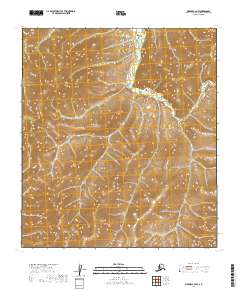
2019 Map of Medfra C-6 NW
USGS Topo · Published 2019About this map
The N Fork Innoko River winds through this interior Alaskan wilderness, cutting through high, ridged terrain that dominates the landscape. Located within the Yukon-Koyukuk Census Area, this specific quadrangle highlights the complex topography of the region, where steep slopes and narrow valleys define the drainage patterns of the upper Innoko basin. The map is primarily structured by the public land survey system, dividing the land into townships t20s r15e, t20s r16e, t21s r15e, and t21s r16e. These survey boundaries provide the only human-imposed framework on a landscape devoid of named settlements, roads, or structures, reflecting the extreme isolation of this portion of the Alaska interior. The detailed contour lines reveal a world of high elevations and sharp relief, centered around the life-giving waterway of the North Fork.
Find a feature on this map
5 named features on this map. Tap any name to fly to it.
Don’t see what you’re looking for? This feature index may not catch every label — zoom into the map to look around manually.
Map Details
Editions of this 2019 Medfra C-6 NW Map
This is the sole edition of this map. No revisions or reprints were ever made.
Other maps of this area

1950 · Medfra
USGS Topo · 1:250,000

1951 · Ophir
USGS Topo · 1:250,000

1954 · Medfra C-6
USGS Topo · 1:63,360

1954 · Medfra D-6
USGS Topo · 1:63,360
1954 · Ophir D-1
USGS Topo · 1:63,360

1954 · Ophir C-1
USGS Topo · 1:63,360

1954 · Ophir
USGS Topo · 1:250,000

1959 · Medfra
USGS Topo · 1:250,000
2019 · Ophir C-1 NE
USGS Topo · 1:25,000
2019 · Medfra C-6 SW
USGS Topo · 1:25,000