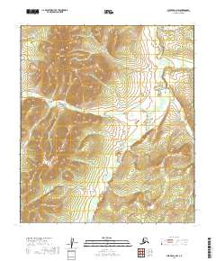
2019 Map of Medfra D-1 NW
USGS Topo · Published 2019About this map
Novi Mtn rises as the prominent topographic feature in this interior Alaskan wilderness, part of the Yukon-Koyukuk Census Area. The landscape is defined by the winding course of the Sethkokna River and its major tributary, the Paradise Fork Sethkokna River. These waterways form a complex drainage pattern across the central and southern portions of the quadrangle, joined by smaller streams like Lind Cr and Sischu Cr in the east. This 2019 survey documents a region devoid of developed roads or settlements, where the primary geographical markers are the natural relief and the historical Township and Range survey lines that segment the river valleys. The map illustrates the remote hydrology of the Sethkokna basin before it joins larger Alaskan systems, providing a clear record of the area's untouched terrain.
Find a feature on this map
14 named features on this map. Tap any name to fly to it.
Don’t see what you’re looking for? This feature index may not catch every label — zoom into the map to look around manually.
Map Details
Editions of this 2019 Medfra D-1 NW Map
This is the sole edition of this map. No revisions or reprints were ever made.
Other maps of this area

1950 · Medfra
USGS Topo · 1:250,000

1951 · Ruby
USGS Topo · 1:250,000

1952 · Ruby A-2
USGS Topo · 1:63,360

1952 · Ruby A-1
USGS Topo · 1:63,360

1952 · Ruby
USGS Topo · 1:250,000

1958 · Medfra D-2
USGS Topo · 1:63,360

1958 · Medfra D-1
USGS Topo · 1:63,360

1959 · Medfra
USGS Topo · 1:250,000

1964 · Ruby
USGS Topo · 1:250,000
2019 · Medfra D-2 SE
USGS Topo · 1:25,000