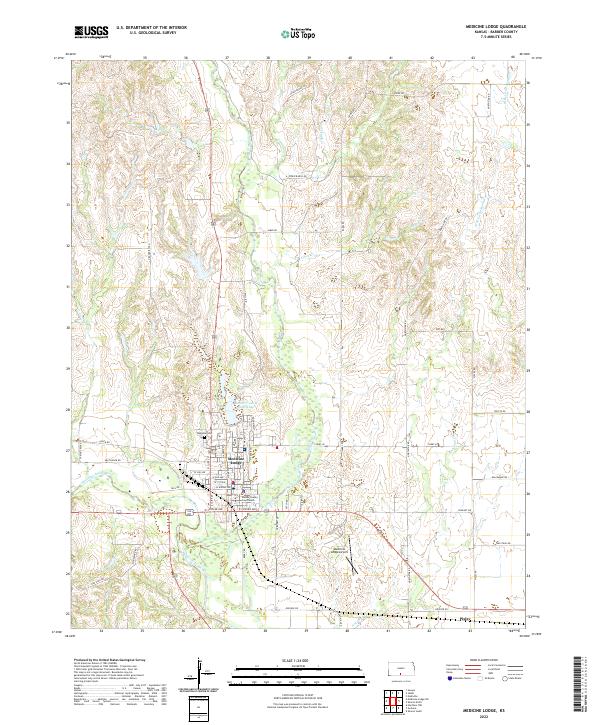
2022 Map of Medicine Lodge
USGS Topo · Published 2022About this map
Medicine Lodge serves as the focal point of this Barber County landscape, positioned where the Medicine Lodge River meets its local tributaries. The town's layout is anchored by the Barber County Courthouse and extends north toward the Barber County State Lake, illustrating a community deeply connected to its water sources. To the northwest, Highland Cem provides a point of genealogical interest overlooking the valley. The terrain is defined by a dendritic drainage pattern, with Elm Creek, Short Cr, and Threemile Cr carving through the hills. This contemporary survey captures the modern infrastructure of the region, including the Medicine Lodge Airport and the small settlement of Pixley to the southeast. The network of ranch roads and lanes, such as Chain Ranch Rd and Ridge Rd, reflects the ongoing importance of large-scale land management in the Kansas prairie.
Find a feature on this map
58 named features on this map. Tap any name to fly to it.
Don’t see what you’re looking for? This feature index may not catch every label — zoom into the map to look around manually.
Map Details
Editions of this 2022 Medicine Lodge Map
This is the sole edition of this map. No revisions or reprints were ever made.
Other maps of this area

1889 · Anthony
USGS Topo · 1:125,000

1891 · Medicine Lodge
USGS Topo · 1:125,000

1891 · Anthony
USGS Topo · 1:125,000

1893 · Medicine Lodge
USGS Topo · 1:125,000

1955 · Pratt
USGS Topo · 1:250,000

1959 · Pratt
USGS Topo · 1:250,000

1972 · Sharon South
USGS Topo · 1:24,000

1973 · Hardtner NW
USGS Topo · 1:24,000
1973 · Isabel
USGS Topo · 1:24,000
1973 · Gerlane
USGS Topo · 1:24,000