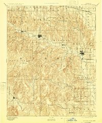
1893 Map of Medicine Lodge
USGS Topo · Published 1925About this map
Medicine Lodge serves as the central hub of this 1890 survey of south-central Kansas, where the rolling Gypsum Hills meet the drainage basins of the Medicine Lodge River and Salt Fork Creek. The geography reveals a transition from the agricultural plains to more dissected terrain, with settlements like Sun City and Lake City established along the river valleys. The northern reach of the map is defined by the Atchison Topeka and Santa Fe Railroad, specifically the section passing through Isabel, which influenced the growth of early trading centers like Elm Mills. This landscape was documented shortly after the peak of the local cattle boom, showing a network of small outposts including Deer Head, Etna, and Hardtner near the Oklahoma border. The concentration of place names and schools in townships such as Kiowa and Elmwood reflects the dense pattern of late nineteenth-century homesteading across Barber County.
Find a feature on this map
62 named features on this map. Tap any name to fly to it.
Don’t see what you’re looking for? This feature index may not catch every label — zoom into the map to look around manually.
Map Details
Editions of this 1893 Medicine Lodge Map
5 editions found

Other maps of this area

1889 · Anthony
USGS Topo · 1:125,000

1889 · Kinsley
USGS Topo · 1:125,000

1891 · Medicine Lodge
USGS Topo · 1:125,000

1891 · Anthony
USGS Topo · 1:125,000

1892 · Kinsley
USGS Topo · 1:125,000

1892 · Kingman
USGS Topo · 1:125,000

1892 · Coldwater
USGS Topo · 1:125,000

1892 · Pratt
USGS Topo · 1:125,000

1893 · Medicine Lodge
USGS Topo · 1:125,000

1894 · Kinsley
USGS Topo · 1:125,000