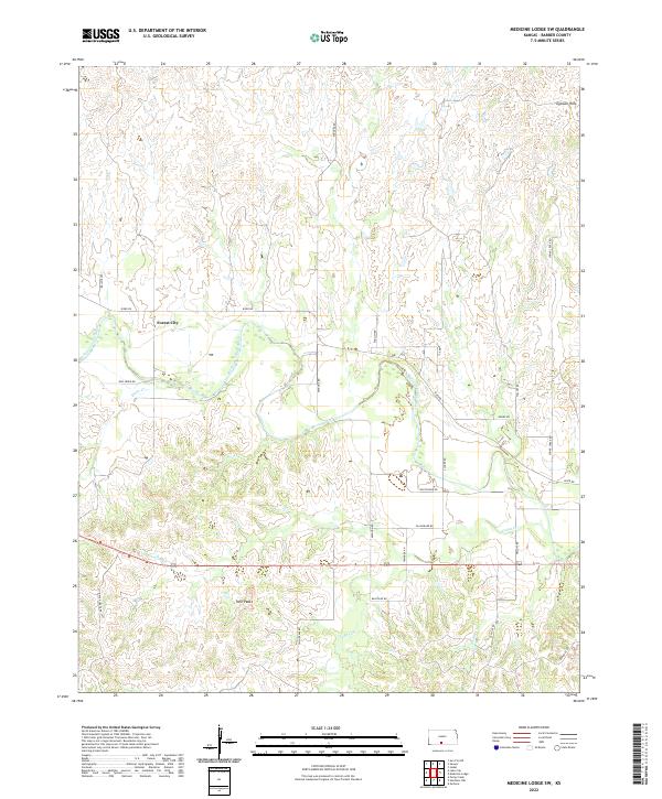
2022 Map of Medicine Lodge SW
USGS Topo · Published 2022About this map
The Medicine Lodge River carves a winding path through this corner of Barber County, defining the drainage patterns for the surrounding landscape. The area is characterized by the distinct topography of the Gypsum Hills, where elevation changes are marked by features like Twin Peaks. While the settlement of Forest City remains a central point of interest for local history, the map is largely defined by its network of rural roads and creek systems, including Bitter Cr, Cedar Cr, and Walnut Cr. These waterways dictate the placement of local connectors such as River Rd and Bitter Creek Rd, which follow the contours of the river valley. This survey reflects the enduring agricultural and ranching layout of the region, where section lines and township boundaries like t31s r13w organize the open terrain.
Find a feature on this map
28 named features on this map. Tap any name to fly to it.
Don’t see what you’re looking for? This feature index may not catch every label — zoom into the map to look around manually.
Map Details
Editions of this 2022 Medicine Lodge SW Map
This is the sole edition of this map. No revisions or reprints were ever made.
Other maps of this area

1891 · Medicine Lodge
USGS Topo · 1:125,000

1893 · Medicine Lodge
USGS Topo · 1:125,000

1955 · Pratt
USGS Topo · 1:250,000

1959 · Pratt
USGS Topo · 1:250,000

1973 · Hardtner NW
USGS Topo · 1:24,000
1973 · Sun City NE
USGS Topo · 1:24,000
1973 · Isabel
USGS Topo · 1:24,000
1973 · Pump Creek
USGS Topo · 1:24,000
1973 · Lake City
USGS Topo · 1:24,000
1973 · Gerlane
USGS Topo · 1:24,000