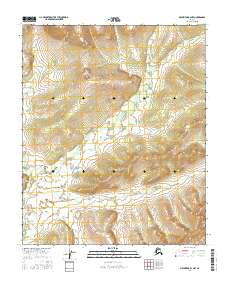
2016 Map of Melozitna B-4 NW
USGS Topo · Published 2016About this map
Glacial landforms and high-altitude wetlands define this remote interior Alaskan landscape within the Melozitna region. The terrain is structured by a complex network of unnamed small lakes and ponds concentrated in the low-lying central basin, surrounded by significant elevation gains that reach over 2,000 feet in the northern corners. Surveyed through the Public Land Survey System, the area is divided among the townships of T1n R19e, T1n R20e, T1s R19e, and T1s R20e. The lack of named infrastructure or settlements indicates a wilderness area primarily shaped by natural drainage patterns and seasonal water bodies, offering a clear view of the subarctic environment before any major human development or road networks were established.
Find a feature on this map
4 named features on this map. Tap any name to fly to it.
Don’t see what you’re looking for? This feature index may not catch every label — zoom into the map to look around manually.
Map Details
Editions of this 2016 Melozitna B-4 NW Map
This is the sole edition of this map. No revisions or reprints were ever made.
Other maps of this area

1951 · Melozitna
USGS Topo · 1:250,000

1954 · Melozitna C-4
USGS Topo · 1:63,360
1954 · Melozitna B-4
USGS Topo · 1:63,360

1954 · Melozitna C-5
USGS Topo · 1:63,360
1954 · Melozitna B-5
USGS Topo · 1:63,360

1956 · Melozitna
USGS Topo · 1:250,000
2016 · Melozitna B-5 SE
USGS Topo · 1:25,000
2016 · Melozitna C-5 SE
USGS Topo · 1:25,000
2016 · Melozitna B-5 NE
USGS Topo · 1:25,000
2016 · Melozitna B-4 SE
USGS Topo · 1:25,000