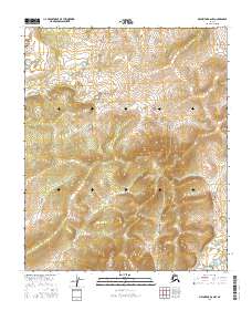
2016 Map of Melozitna B-6 NW
USGS Topo · Published 2016About this map
The Alaskan wilderness within the Yukon-Koyukuk region is defined by its dramatic topographic relief and remote character. This 2016 survey, produced by the U.S. Geological Survey and the BLM, documents a vast interior landscape organized by the Public Land Survey System. The map area is divided between the northern and southern townships of T1n R14e, T1n R15e, T1s R14e, and T1s R15e. While the sheet lacks named settlements or man-made structures, it provides an exacting record of the natural hydrology and elevation contours as they existed in the early 21st century. The map synthesizes data from the Alaska Dept. of Transportation and the FWS National Wetlands Inventory, capturing a snapshot of this unpopulated terrain before any potential infrastructure or climate-driven changes altered its contours.
Find a feature on this map
4 named features on this map. Tap any name to fly to it.
Don’t see what you’re looking for? This feature index may not catch every label — zoom into the map to look around manually.
Map Details
Editions of this 2016 Melozitna B-6 NW Map
This is the sole edition of this map. No revisions or reprints were ever made.
Other maps of this area

1951 · Kateel River
USGS Topo · 1:250,000

1951 · Melozitna
USGS Topo · 1:250,000

1952 · Kateel River B-1
USGS Topo · 1:63,360

1954 · Melozitna C-6
USGS Topo · 1:63,360

1954 · Kateel River C-1
USGS Topo · 1:63,360
1954 · Melozitna B-6
USGS Topo · 1:63,360

1955 · Kateel River
USGS Topo · 1:250,000

1956 · Melozitna
USGS Topo · 1:250,000
2016 · Kateel River C-1 SE
USGS Topo · 1:25,000
2016 · Kateel River B-1 NE
USGS Topo · 1:25,000