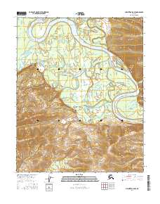
2016 Map of Melozitna D-5 SE
USGS Topo · Published 2016About this map
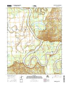
The Koyukuk River dominates this interior landscape, winding in broad, sweeping meanders across the northern and eastern portions of the map. In this reach of the river valley, the water creates complex hydrological patterns including the Batza Slough, which bypasses the main channel to the north, and various oxbow formations indicating a shifting riverbed over time. To the south, the terrain rises sharply into the Takhakhdona Hills, providing a stark contrast to the low-lying wetlands and fluvial plains of the river basin. Smaller tributaries like Willow Cr feed into the system, illustrating the drainage patterns that define the region. This 2016 survey, produced in cooperation with the Alaska Dept. of Transportation, provides a clear view of the natural topography before any significant modern infrastructure reached this part of the Yukon-Koyukuk region.
Find a feature on this map
11 named features on this map. Tap any name to fly to it.
Don’t see what you’re looking for? This feature index may not catch every label — zoom into the map to look around manually.
Map Details
Editions of this 2016 Melozitna D-5 SE Map
This is the sole edition of this map. No revisions or reprints were ever made.
Other maps of this area

1951 · Melozitna
USGS Topo · 1:250,000

1954 · Melozitna C-4
USGS Topo · 1:63,360

1954 · Melozitna C-5
USGS Topo · 1:63,360

1954 · Melozitna D-5
USGS Topo · 1:63,360

1954 · Melozitna D-4
USGS Topo · 1:63,360

1956 · Melozitna
USGS Topo · 1:250,000
2016 · Melozitna D-5 NE
USGS Topo · 1:25,000
2016 · Melozitna C-5 NE
USGS Topo · 1:25,000
2016 · Melozitna D-5 SW
USGS Topo · 1:25,000
2016 · Melozitna D-5 NW
USGS Topo · 1:25,000