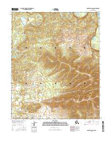
2016 Map of Melozitna D-5 SW
USGS Topo · Published 2016About this map
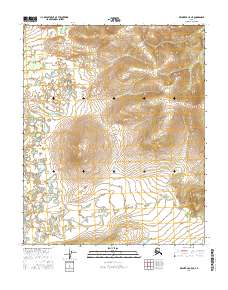
Dulbi Flats dominates the western portion of this interior landscape, where a dense network of small lakes and marshes covers the low-lying terrain. The transition from these wetlands to the higher ground of the eastern quadrant is marked by the rising slopes of Bear Mtn, which serves as a prominent landmark in the Yukon-Koyukuk region. This 2016 survey by the U.S. Geological Survey details a landscape largely defined by its natural topography, illustrating the sharp contrast between the saturated bottomlands and the upland peaks. The absence of roads or permanent settlements within this particular quadrant emphasizes the wilderness character of the Melozitna River drainage area at this time.
Find a feature on this map
8 named features on this map. Tap any name to fly to it.
Don’t see what you’re looking for? This feature index may not catch every label — zoom into the map to look around manually.
Map Details
Editions of this 2016 Melozitna D-5 SW Map
This is the sole edition of this map. No revisions or reprints were ever made.
Other maps of this area

1951 · Melozitna
USGS Topo · 1:250,000

1954 · Melozitna C-5
USGS Topo · 1:63,360

1954 · Melozitna C-6
USGS Topo · 1:63,360

1954 · Melozitna D-5
USGS Topo · 1:63,360

1954 · Melozitna D-6
USGS Topo · 1:63,360

1956 · Melozitna
USGS Topo · 1:250,000
2016 · Melozitna D-5 NE
USGS Topo · 1:25,000
2016 · Melozitna C-6 NE
USGS Topo · 1:25,000
2016 · Melozitna D-6 SE
USGS Topo · 1:25,000
2016 · Melozitna C-5 NE
USGS Topo · 1:25,000