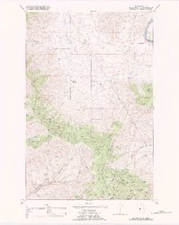
1988 Map of Melton Ranch
USGS Topo · Published 1988About this map
Melton Ranch and other family-held lands define this stretch of the Flathead River valley on the Flathead Indian Reservation during the late 1980s. The landscape is characterized by a series of high-plateau cattle operations and complex drainage systems, including Whiskey Creek and the meandering Little Bitterroot River. The terrain transitions from the river bottom up into the broken country of Ferry Basin and Racehorse Gulch. Unlike more developed regions, the human footprint here is primarily ranching-focused, with landmarks like Jennings Ranch and Haynes Ranch serving as the primary points of reference. An extensive network of BIA-maintained roads, such as FB-2010 and FB-1000, provides access through the draws and across the ridgelines separating Sanders and Lake counties.
Find a feature on this map
93 named features on this map. Tap any name to fly to it.
Don’t see what you’re looking for? This feature index may not catch every label — zoom into the map to look around manually.
Map Details
Editions of this 1988 Melton Ranch Map
This is the sole edition of this map. No revisions or reprints were ever made.
Other maps of this area

1920 · Flathead Lake
USGS Topo · 1:125,000

1956 · Wallace
USGS Topo · 1:250,000

1959 · Perma
USGS Topo · 1:62,500

1960 · Wallace
USGS Topo · 1:250,000

1964 · Dixon
USGS Topo · 1:24,000

1964 · Mc Donald
USGS Topo · 1:24,000

1964 · Melton Ranch
USGS Topo · 1:24,000

1964 · Markle Pass
USGS Topo · 1:24,000

1965 · Sloan
USGS Topo · 1:24,000

1965 · Oliver Point
USGS Topo · 1:24,000