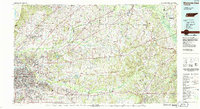
1986 Map of Memphis East
USGS Topo · Published 1986About this map
The Mississippi River defines the western edge of this West Tennessee landscape, where the urban expansion of Memphis meets the bottomlands of the Hatchie River. In the mid-1980s, the region shows a complex mix of industrial infrastructure and preserved natural spaces, from the sprawling U S Naval Air Station to the protected wetlands of the Hatchie National Wildlife Refuge. The drainage patterns of the Loosahatchie River and Wolf River dominate the interior, punctuated by established rural centers like Somerville and Mason.
Find a feature on this map
121 named features on this map. Tap any name to fly to it.
Don’t see what you’re looking for? This feature index may not catch every label — zoom into the map to look around manually.
Map Details
Editions of this 1986 Memphis East Map
2 editions found
Other maps of this area

1916 · Memphis
USGS Topo · 1:62,500

1925 · Memphis
USGS Topo · 1:48,000

1927 · Memphis
USGS Topo · 1:62,500

1931 · Jericho
USGS Topo · 1:62,500

1932 · Horn Lake
USGS Topo · 1:48,000

1935 · Horn Lake
USGS Topo · 1:62,500

1939 · Jericho
USGS Topo · 1:62,500

1939 · Memphis
USGS Topo · 1:62,500

1939 · Evadale
USGS Topo · 1:62,500

1942 · Millington
USGS Topo · 1:62,500