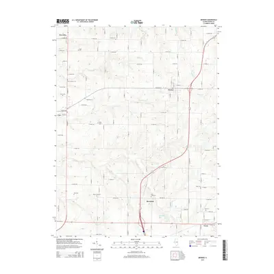
2015 Map of Mendon
USGS Topo · Published 2015About this map
Mendon serves as a central hub for this portion of Adams County, where a network of rural roads intersects with major north-south transit corridors. The landscape is defined by the drainage patterns of Ursa Cr and Jenkins Cr, which carve through the till plains typical of Western Illinois. For researchers of local lineage, the map provides a remarkable concentration of family and community burial grounds, including the Stone Family Cem and the Wesley Chapel Cem near Bloomfield. The transition from the small village of Ursa to the dispersed farmsteads near Marcelline and Fowler illustrates the persistent agricultural character of the region. Distinctive natural features like Jug Lake and the winding course of Rock Cr stand out against the geometric grid of county roads, offering a clear view of how early settlement and modern land management have adapted to the local topography.
Find a feature on this map
56 named features on this map. Tap any name to fly to it.
Don’t see what you’re looking for? This feature index may not catch every label — zoom into the map to look around manually.
Map Details
Editions of this 2015 Mendon Map
This is the sole edition of this map. No revisions or reprints were ever made.
Other maps of this area

1925 · Quincy
USGS Topo · 1:62,500

1925 · Liberty
USGS Topo · 1:62,500

1927 · Liberty
USGS Topo · 1:62,500

1944 · Quincy
USGS Topo · 1:62,500

1945 · Quincy
USGS Topo · 1:62,500

1946 · Mendon
USGS Topo · 1:62,500

1948 · Quincy
USGS Topo · 1:250,000

1948 · Mendon
USGS Topo · 1:62,500

1948 · Camp Point
USGS Topo · 1:62,500

1956 · Quincy
USGS Topo · 1:250,000