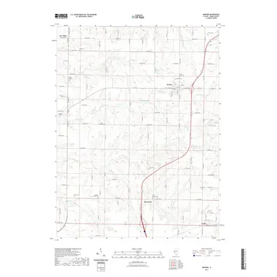
2021 Map of Mendon
USGS Topo · Published 2021About this map
Mendon serves as the central hub of this northern Adams County landscape, where the agricultural grid is deeply etched by the winding drainages of Ursa Cr and Rock Cr. The map reveals a dense network of historic burial grounds that speak to generations of rural settlement, including family-named sites like Stone Family Cem and Benton Family Cem. Small communities such as Ursa, Bloomfield, and Marcelline anchor the outlying sections, connected by a structured system of township roads. The topography is defined by the sharp contrast between the level upland farms and the timbered breaks leading down to Jug Lake and Frazier Cr. This modern survey preserves the locations of country churches and their associated cemeteries, such as Wesley Chapel Cem and Saint Joseph Cem, which remain vital landmarks for local history and genealogical research in this part of Illinois.
Find a feature on this map
62 named features on this map. Tap any name to fly to it.
Don’t see what you’re looking for? This feature index may not catch every label — zoom into the map to look around manually.
Map Details
Editions of this 2021 Mendon Map
This is the sole edition of this map. No revisions or reprints were ever made.
Other maps of this area

1925 · Quincy
USGS Topo · 1:62,500

1925 · Liberty
USGS Topo · 1:62,500

1927 · Liberty
USGS Topo · 1:62,500

1944 · Quincy
USGS Topo · 1:62,500

1945 · Quincy
USGS Topo · 1:62,500

1946 · Mendon
USGS Topo · 1:62,500

1948 · Quincy
USGS Topo · 1:250,000

1948 · Mendon
USGS Topo · 1:62,500

1948 · Camp Point
USGS Topo · 1:62,500

1956 · Quincy
USGS Topo · 1:250,000