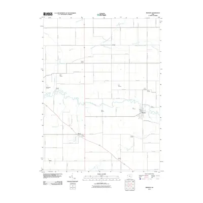
2010 Map of Mendon
USGS Topo · Published 2010About this map
Mendon serves as the primary hub of this Western Ohio landscape, situated at the confluence of the Saint Marys River and Twelvemile Creek. The village grid includes the Mendon Post Office and Mendon Cemetery, surrounded by a meticulously managed drainage network essential for the region's agricultural productivity. Labels such as Ayre Ditch, Dennison Ditch, and Frisinger Ditch illustrate the human intervention required to farm this flat prairie land.
Find a feature on this map
72 named features on this map. Tap any name to fly to it.
Don’t see what you’re looking for? This feature index may not catch every label — zoom into the map to look around manually.
Map Details
Editions of this 2010 Mendon Map
This is the sole edition of this map. No revisions or reprints were ever made.
Other maps of this area

1911 · Spencerville
USGS Topo · 1:62,500

1911 · Delphos
USGS Topo · 1:62,500

1914 · Celina
USGS Topo · 1:62,500

1914 · Van Wert
USGS Topo · 1:62,500

1944 · Delphos
USGS Topo · 1:62,500

1944 · Van Wert
USGS Topo · 1:62,500

1944 · Celina
USGS Topo · 1:62,500

1944 · Spencerville
USGS Topo · 1:62,500

1953 · Muncie
USGS Topo · 1:250,000

1956 · Muncie
USGS Topo · 1:250,000