2023 Map of Mendon
USGS Topo · Published 2023About this map
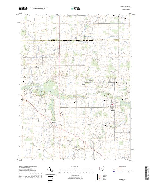
Saint Marys River meanders across this landscape, defining the topography of central Mercer County near the village of Mendon. The area is characterized by an extensive network of agricultural drainage, including Ayre Ditch, Frisinger Ditch, and Twelvemile Creek, which illustrate the long-term transformation of the Great Black Swamp into productive Ohio farmland. For genealogists, the map is particularly valuable for its high density of family-named burial grounds, such as Frysinger Cem, Mount Olive Cem, and Tomlinson Cem. The settlement of Tama sits in the southwestern portion of the sheet, while major transportation corridors like Us Rte 127 and Us Rte 33 intersect the grid of township and county roads. This survey provides a precise view of rural infrastructure and land management in the early twenty-first century.
Find a feature on this map
86 named features on this map. Tap any name to fly to it.
Don’t see what you’re looking for? This feature index may not catch every label — zoom into the map to look around manually.
Map Details
Editions of this 2023 Mendon Map
This is the sole edition of this map. No revisions or reprints were ever made.