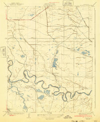
1924 Map of Mendota
USGS Topo · Published 1940About this map
The San Joaquin River winds through this central California landscape, defining the boundary between Madera and Fresno Counties. In the early 1920s, this region was characterized by large agricultural holdings and an intricate system of water management essential for valley life. Significant operations like Columbia Ranch, Aliso Ranch, and Pomona Ranch are shown alongside the infrastructure that supported them, including the Chowchilla Canal and Aliso Canal. Near the southern edge of the sheet, the town of Mendota serves as a local hub along the S P R R line. The terrain is marked by seasonal waterways and depressions such as Mowry Lake, Lone Willow Slough, and Fresno Slough, illustrating the natural hydrologic complexity of the basin before later twentieth-century modifications further altered the valley floor.
Find a feature on this map
19 named features on this map. Tap any name to fly to it.
Don’t see what you’re looking for? This feature index may not catch every label — zoom into the map to look around manually.
Map Details
Editions of this 1924 Mendota Map
2 editions found

Other maps of this area

1920 · Bonita Ranch
USGS Topo · 1:31,680

1921 · Mendota
USGS Topo · 1:31,680

1921 · Bonita Ranch
USGS Topo · 1:31,680

1922 · Tufts Ranch
USGS Topo · 1:31,680

1922 · Pozo Farm
USGS Topo · 1:31,680

1922 · Kentucky Well
USGS Topo · 1:31,680

1923 · Firebaugh
USGS Topo · 1:31,680

1924 · Jamesan
USGS Topo · 1:31,680

1924 · Tranquillity
USGS Topo · 1:31,680

1924 · Gravelly Ford
USGS Topo · 1:31,680