
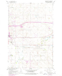
1962 Map of Menoken SW
USGS Topo · Published 1964About this map
The eastern edges of Bismarck meet the meandering course of Apple Creek in this early 1960s survey. The landscape is defined by the intersection of transportation and state infrastructure, notably where the Northern Pacific and Soo Line railroads converge near the State Penitentiary. To the south, the Bismarck Airport and a dedicated Radio Facility occupy the flatlands, while the northern sections of Gibbs Township remain primarily rural. Local education and community landmarks are scattered across the terrain, including Wilson Sch, Gibbs Sch, and School No 11. Leisure and mid-century utility are also evident, with the Country Club and Cypert Park appearing alongside a Fish Hatchery and a Drive-in Theater. The transition from urban center to open prairie is marked by these small pockets of development and the winding paths of Hay Creek.
Find a feature on this map
26 named features on this map. Tap any name to fly to it.
Don’t see what you’re looking for? This feature index may not catch every label — zoom into the map to look around manually.
Map Details
Editions of this 1962 Menoken SW Map
2 editions found
Other maps of this area

1907 · Bismarck
USGS Topo · 1:125,000

1950 · Bismarck
USGS Topo · 1:24,000

1951 · Menoken SW
USGS Topo · 1:24,000

1951 · Bismarck
USGS Topo · 1:62,500

1951 · Menoken
USGS Topo · 1:62,500

1954 · Bismarck
USGS Topo · 1:250,000

1958 · Bismarck
USGS Topo · 1:250,000

1962 · Sugarloaf Butte
USGS Topo · 1:24,000

1962 · Schmidt
USGS Topo · 1:24,000

1962 · Bismarck
USGS Topo · 1:24,000