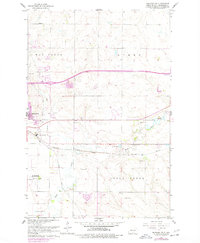
1962 Map of Menoken SW
USGS Topo · Published 1977About this map
State Penitentiary and the expanding eastern edge of Bismarck anchor this 1960s landscape, illustrating the transition from institutional and industrial lands to open Dakota prairie. The Northern Pacific railroad cuts a straight east-west path across the center, serving as a primary corridor through Pierce and beyond. The winding courses of Apple Creek and Hay Creek provide a natural contrast to the grid-like development of trailer parks and the early layout of the Country Club.
Find a feature on this map
24 named features on this map. Tap any name to fly to it.
Don’t see what you’re looking for? This feature index may not catch every label — zoom into the map to look around manually.
Map Details
Editions of this 1962 Menoken SW Map
2 editions found
Other maps of this area

1907 · Bismarck
USGS Topo · 1:125,000

1950 · Bismarck
USGS Topo · 1:24,000

1951 · Menoken SW
USGS Topo · 1:24,000

1951 · Bismarck
USGS Topo · 1:62,500

1951 · Menoken
USGS Topo · 1:62,500

1954 · Bismarck
USGS Topo · 1:250,000

1958 · Bismarck
USGS Topo · 1:250,000

1962 · Sugarloaf Butte
USGS Topo · 1:24,000

1962 · Schmidt
USGS Topo · 1:24,000

1962 · Menoken SW
USGS Topo · 1:24,000