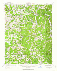
1949 Map of Meramec Spring
USGS Topo · Published 1963About this map
St James serves as a northern anchor for this Ozark landscape, where the St Louis San Francisco railroad and U.S. 66 cut through the hills of Phelps and Crawford counties. The map documents a period when rural education was highly localized, evidenced by dozens of district schools like Flat Grove School, Wolfe School, and Spring Hill School. A significant extractive economy is visible in the southeastern corner, where iron or mineral deposits are marked by several banks and mines, including Kelley Bank, Nine Sixteen Bank, and the Bronson Mine.
Find a feature on this map
92 named features on this map. Tap any name to fly to it.
Don’t see what you’re looking for? This feature index may not catch every label — zoom into the map to look around manually.
Map Details
Editions of this 1949 Meramec Spring Map
2 editions found

Other maps of this area

1903 · Sullivan
USGS Topo · 1:125,000

1912 · Rolla
USGS Topo · 1:62,500

1928 · Meramec Spring
USGS Topo · 1:62,500

1932 · Steelville
USGS Topo · 1:48,000

1933 · Steelville
USGS Topo · 1:62,500

1934 · Redbird
USGS Topo · 1:62,500

1937 · Steelville
USGS Topo · 1:62,500

1937 · Edgar Springs
USGS Topo · 1:48,000

1937 · Vienna
USGS Topo · 1:62,500

1938 · Redbird
USGS Topo · 1:62,500