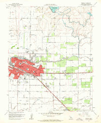
1961 Map of Merced
USGS Topo · Published 1963About this map
The city of Merced serves as a dense residential and administrative hub in the early 1960s, its urban core defined by landmarks like the Courthouse, City Hall, and the Post Office. This era shows a community heavily invested in its local institutions, evidenced by a high density of neighborhood schools such as Burbank School, Muir School, and Tenaya Junior High School. The local economy and transport are anchored by the dual lines of the Southern Pacific and the Atchison Topeka and Santa Fe railroads, which parallel major thoroughfares like Santa Fe Drive.
Find a feature on this map
59 named features on this map. Tap any name to fly to it.
Don’t see what you’re looking for? This feature index may not catch every label — zoom into the map to look around manually.
Map Details
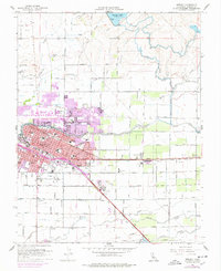
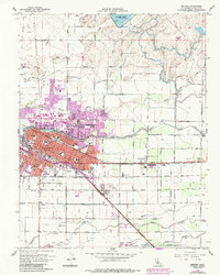
Editions of this 1961 Merced Map
3 editions found
Other maps of this area

1914 · Merced
USGS Topo · 1:31,680

1916 · Hopeton
USGS Topo · 1:31,680

1917 · Winton
USGS Topo · 1:31,680

1917 · Merced
USGS Topo · 1:31,680

1918 · Lingard
USGS Topo · 1:31,680

1918 · Atwater
USGS Topo · 1:31,680

1918 · Sandy Mush
USGS Topo · 1:31,680

1918 · Planada
USGS Topo · 1:31,680

1919 · Haystack Mountain
USGS Topo · 1:31,680

1919 · Plainsberg
USGS Topo · 1:31,680