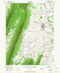
1943 Map of Mercersburg
USGS Topo · Published 1965About this map
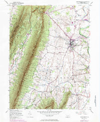
Tuscarora Mountain dominates the western landscape of this mid-century Franklin County survey, acting as a natural barrier between the agricultural valley and the rugged Buchanan State Forest. The town of Mercersburg serves as a central hub, characterized by its established infrastructure including the prominent Mercersburg Academy and several local landmarks like the Union Church. The surrounding valley floor is dotted with small settlements such as Cove Gap, Claylick, and Shimpstown, each supported by a network of rural schoolhouses like Lafayette School and Montpelier School.
Find a feature on this map
47 named features on this map. Tap any name to fly to it.
Don’t see what you’re looking for? This feature index may not catch every label — zoom into the map to look around manually.
Map Details
Editions of this 1943 Mercersburg Map
6 editions found

Other maps of this area

1899 · Hancock
USGS Topo · 1:62,500

1900 · Mercersburg
USGS Topo · 1:62,500

1901 · Hancock
USGS Topo · 1:62,500

1902 · Mercersburg
USGS Topo · 1:62,500

1912 · Williamsport
USGS Topo · 1:62,500

1925 · Needmore
USGS Topo · 1:48,000

1935 · Needmore
USGS Topo · 1:62,500

1939 · Needmore
USGS Topo · 1:62,500

1942 · Hagerstown
USGS Topo · 1:125,000

1943 · Hagerstown
USGS Topo · 1:125,000