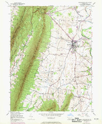
1943 Map of Mercersburg
USGS Topo · Published 1969About this map
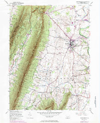
The town of Mercersburg serves as the focal point of this 1943 survey, centered in a landscape defined by the sharp rise of Tuscarora Mountain to the west. This era of Franklin County history is captured just as the Penn Central rail line connected the borough to Mercersburg Junction and Dickey, facilitating local commerce and movement across the valley. The map reveals a high density of rural educational institutions, including the prominent Mercersburg Academy and several local country schools such as Buchanan Sch near Cove Gap and Claylick Sch in the south.
Find a feature on this map
44 named features on this map. Tap any name to fly to it.
Don’t see what you’re looking for? This feature index may not catch every label — zoom into the map to look around manually.
Map Details
Editions of this 1943 Mercersburg Map
6 editions found

Other maps of this area

1899 · Hancock
USGS Topo · 1:62,500

1900 · Mercersburg
USGS Topo · 1:62,500

1901 · Hancock
USGS Topo · 1:62,500

1902 · Mercersburg
USGS Topo · 1:62,500

1912 · Williamsport
USGS Topo · 1:62,500

1925 · Needmore
USGS Topo · 1:48,000

1935 · Needmore
USGS Topo · 1:62,500

1939 · Needmore
USGS Topo · 1:62,500

1942 · Hagerstown
USGS Topo · 1:125,000

1943 · Hagerstown
USGS Topo · 1:125,000