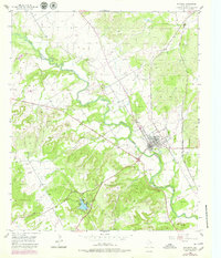
1955 Map of Meridian
USGS Topo · Published 1979About this map
The North Bosque River winds through the heart of Bosque County, shaping the landscape around the settlement of Meridian. This mid-century survey captures the town at a stable period of its development, characterized by its position along the Atchison Topeka and Santa Fe railroad line. To the southwest, the expansive Meridian State Park centers on a large reservoir, providing a recreational anchor for the region. The map documents several small family and community landmarks, such as Hanna Cem and a Gravel Pit, which reflect the local industry and genealogy of the area.
Find a feature on this map
13 named features on this map. Tap any name to fly to it.
Don’t see what you’re looking for? This feature index may not catch every label — zoom into the map to look around manually.
Map Details
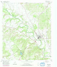
Editions of this 1955 Meridian Map
3 editions found
Other maps of this area

1888 · Meridian
USGS Topo · 1:125,000

1889 · Granbury
USGS Topo · 1:125,000

1894 · Meridian
USGS Topo · 1:125,000

1931 · Morgan
USGS Topo · 1:62,500

1954 · Dallas
USGS Topo · 1:250,000

1954 · Waco
USGS Topo · 1:250,000

1955 · Waco
USGS Topo · 1:250,000

1955 · Clifton
USGS Topo · 1:24,000

1955 · Meridian
USGS Topo · 1:24,000
1955 · Pilot Knob
USGS Topo · 1:24,000