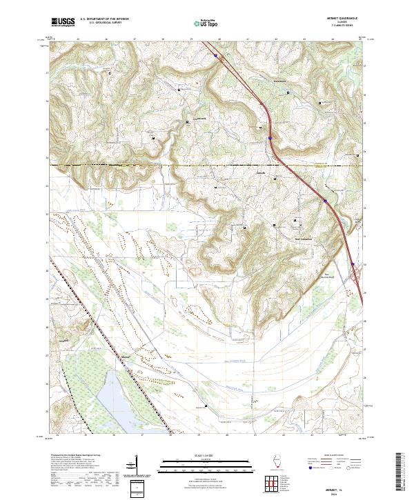
2024 Map of Mermet
USGS Topo · Published 2024About this map
Mermet Lake and its surrounding wetlands anchor the southwestern corner of this landscape, where the boundary between Johnson Co and Massac Co divides a region defined by complex drainage networks. The southern lowlands are heavily managed by a system of man-made waterways, including the New Columbia Ditch, Bear Creek Ditch, and Main Ditch, which redirect water through former marshlands toward the Ohio River basin. In contrast, the northern terrain rises toward distinctive elevations like Blue Knob and Cagle Bluff.
Find a feature on this map
83 named features on this map. Tap any name to fly to it.
Don’t see what you’re looking for? This feature index may not catch every label — zoom into the map to look around manually.
Map Details
Editions of this 2024 Mermet Map
This is the sole edition of this map. No revisions or reprints were ever made.
Other maps of this area

1917 · Brownfield
USGS Topo · 1:62,500

1918 · Vienna
USGS Topo · 1:62,500

1919 · Vienna
USGS Topo · 1:62,500

1926 · Paducah
USGS Topo · 1:62,500

1928 · La Center
USGS Topo · 1:62,500

1929 · Paducah
USGS Topo · 1:62,500

1932 · La Center
USGS Topo · 1:62,500

1940 · Paducah
USGS Topo · 1:62,500

1942 · Vienna
USGS Topo · 1:62,500

1949 · Paducah
USGS Topo · 1:250,000