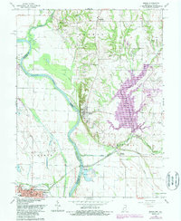
1966 Map of Merom
USGS Topo · Published 1987About this map
The Wabash River serves as the winding boundary between Indiana and Illinois, shaping a landscape of fertile bottomlands and alluvial islands like Merom Island and Eagle Island. On the Indiana side, the town of Merom sits prominently atop The Bluff, overlooking the broad river valley and the low-lying Minnow Slough. This position above the floodplains historically protected the settlement while providing a vantage point over the river's commerce and the tracks of the Illinois Central Gulf railroad.
Find a feature on this map
42 named features on this map. Tap any name to fly to it.
Don’t see what you’re looking for? This feature index may not catch every label — zoom into the map to look around manually.
Map Details
Editions of this 1966 Merom Map
4 editions found
Other maps of this area

1917 · Birds
USGS Topo · 1:62,500

1942 · Fairbanks
USGS Topo · 1:24,000

1942 · Shelburn
USGS Topo · 1:24,000

1942 · Birds
USGS Topo · 1:62,500

1943 · Merom
USGS Topo · 1:24,000

1943 · Carlisle
USGS Topo · 1:24,000

1943 · Sullivan
USGS Topo · 1:24,000

1952 · Fairbanks
USGS Topo · 1:24,000

1952 · Shelburn
USGS Topo · 1:24,000

1953 · Indianapolis
USGS Topo · 1:250,000