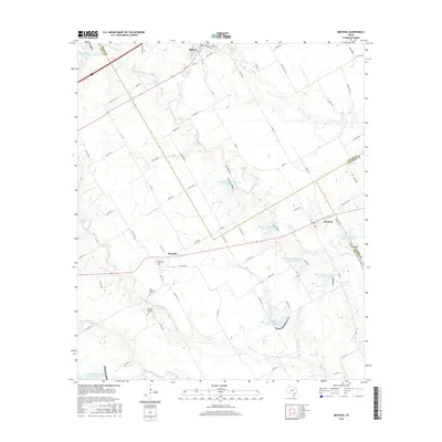
2016 Map of Mertens
USGS Topo · Published 2016About this map
Milford anchors the northern reaches of this Texas landscape where Ellis, Hill, and Navarro counties meet. This 2016 survey highlights the transition from the rolling prairie into the more complex drainage systems of the upper Richland Cr watershed. The settlement of Brandon and the village of Mertens serve as southern focal points, connected by a network of farm-to-market roads and county lanes that follow the natural contours of the terrain.
Find a feature on this map
81 named features on this map. Tap any name to fly to it.
Don’t see what you’re looking for? This feature index may not catch every label — zoom into the map to look around manually.
Map Details
Editions of this 2016 Mertens Map
This is the sole edition of this map. No revisions or reprints were ever made.
Other maps of this area

1891 · Cleburne
USGS Topo · 1:125,000

1892 · Waco
USGS Topo · 1:125,000

1894 · Cleburne
USGS Topo · 1:125,000

1920 · Waco
USGS Topo · 1:125,000

1954 · Dallas
USGS Topo · 1:250,000

1954 · Waco
USGS Topo · 1:250,000

1955 · Waco
USGS Topo · 1:250,000

1956 · Abbott
USGS Topo · 1:24,000

1957 · Irene
USGS Topo · 1:24,000
1957 · Malone
USGS Topo · 1:24,000