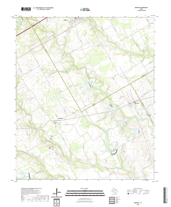
2022 Map of Mertens
USGS Topo · Published 2022About this map
Milford, Brandon, and Mertens anchor this rural landscape where the borders of Hill, Ellis, and Navarro counties converge. The geography is defined by a dense network of creek systems including Richland Cr, Cottonwood Cr, and White Rock Cr, which have been heavily modified for flood control and water management. This is evidenced by the numerous numbered reservoirs, such as Soil Conservation Service Site 42 Reservoir and Soil Conservation Service Site 57 Reservoir, which dot the drainages. Genealogists will find particular value in the documentation of the Old Brandon Cem and Brandon Cem, which serve as physical links to the early families of this agricultural region. The map captures the intricate grid of county roads and farm-to-market routes, like FM 1243, that connect these small Texas communities.
Find a feature on this map
82 named features on this map. Tap any name to fly to it.
Don’t see what you’re looking for? This feature index may not catch every label — zoom into the map to look around manually.
Map Details
Editions of this 2022 Mertens Map
This is the sole edition of this map. No revisions or reprints were ever made.
Other maps of this area

1891 · Cleburne
USGS Topo · 1:125,000

1892 · Waco
USGS Topo · 1:125,000

1894 · Cleburne
USGS Topo · 1:125,000

1920 · Waco
USGS Topo · 1:125,000

1954 · Dallas
USGS Topo · 1:250,000

1954 · Waco
USGS Topo · 1:250,000

1955 · Waco
USGS Topo · 1:250,000

1956 · Abbott
USGS Topo · 1:24,000

1957 · Irene
USGS Topo · 1:24,000
1957 · Malone
USGS Topo · 1:24,000