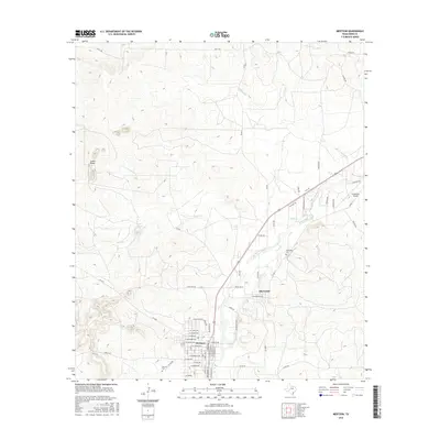
2016 Map of Mertzon
USGS Topo · Published 2016About this map
The town of Mertzon serves as the primary hub in this Irion County landscape, situated where the Edwards Plateau begins its transition. To the northeast lies Sherwood, a community connected by a network of local routes including Ranch Rd 72 and Sissy Rd. The hydrology of the area is defined by the winding course of Spring Cr, which is fed by tributaries such as Lopez Cr and Bull-Run Cr. These waterways historically dictated the placement of settlements and ranches in an otherwise semi-arid environment.
Find a feature on this map
65 named features on this map. Tap any name to fly to it.
Don’t see what you’re looking for? This feature index may not catch every label — zoom into the map to look around manually.
Map Details
Editions of this 2016 Mertzon Map
This is the sole edition of this map. No revisions or reprints were ever made.
Other maps of this area

1895 · Sherwood
USGS Topo · 1:125,000

1928 · Tankersly
USGS Topo · 1:62,500

1954 · San Angelo
USGS Topo · 1:250,000

1957 · Knickerbocker
USGS Topo · 1:62,500

1958 · San Angelo
USGS Topo · 1:250,000

1965 · San Angelo
USGS Topo · 1:250,000

1971 · Noelke
USGS Topo · 1:24,000

1972 · Arden
USGS Topo · 1:24,000
1972 · Hulldale NW
USGS Topo · 1:24,000
1972 · Noelke NE
USGS Topo · 1:24,000