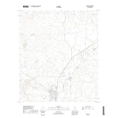
2019 Map of Mertzon
USGS Topo · Published 2019About this map
The town of Mertzon serves as the focal point of this Irion County survey, situated at a junction of regional roads including W Main Ave and N Broadway St. The settlement pattern reflects a modest grid emerging from the West Texas landscape, anchored by the Mertzon Cem to the south. Northwest of the main town site, the terrain rises significantly toward Lopez Peaks, where the headwaters of Lopez Cr and the tucked-away Lopez Spring define the local hydrology.
Find a feature on this map
60 named features on this map. Tap any name to fly to it.
Don’t see what you’re looking for? This feature index may not catch every label — zoom into the map to look around manually.
Map Details
Editions of this 2019 Mertzon Map
This is the sole edition of this map. No revisions or reprints were ever made.
Other maps of this area

1895 · Sherwood
USGS Topo · 1:125,000

1928 · Tankersly
USGS Topo · 1:62,500

1954 · San Angelo
USGS Topo · 1:250,000

1957 · Knickerbocker
USGS Topo · 1:62,500

1958 · San Angelo
USGS Topo · 1:250,000

1965 · San Angelo
USGS Topo · 1:250,000

1971 · Noelke
USGS Topo · 1:24,000

1972 · Arden
USGS Topo · 1:24,000
1972 · Hulldale NW
USGS Topo · 1:24,000
1972 · Noelke NE
USGS Topo · 1:24,000