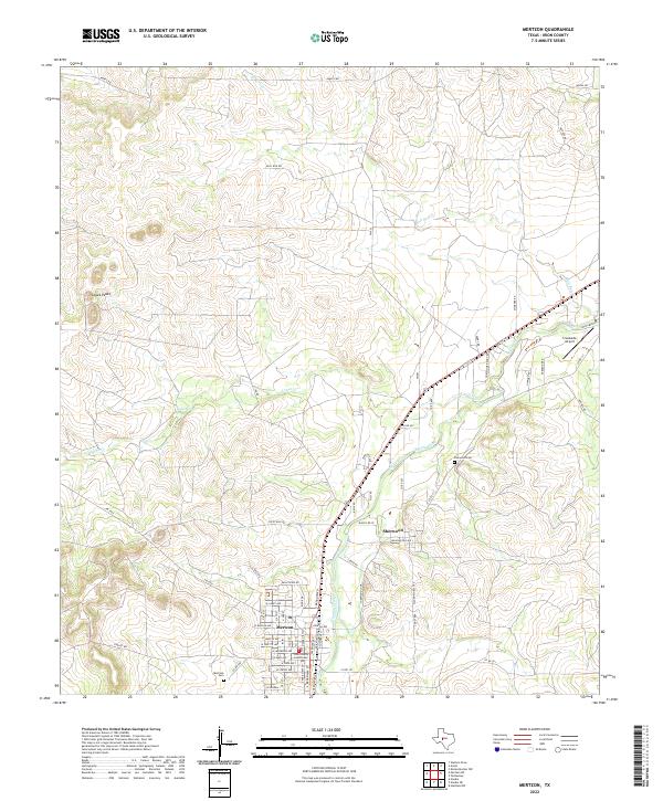
2022 Map of Mertzon
USGS Topo · Published 2022About this map
The Irion County Courthouse anchors the settlement of Mertzon, a West Texas ranching and county seat community situated where the Edwards Plateau begins its descent. This modern survey shows the town's grid including W Juanita Ave and W Duncan Ave, contrasted with the earlier established neighboring community of Sherwood. The surrounding landscape is defined by the drainage systems of Spring Creek, Lopez Cr, and Bull Run Cr, which cut through the limestone terrain to create local landmarks like Lopez Peaks. Genealogists will find interest in the documented locations of both the Mertzon Cem and the Sherwood Cem. The presence of Creekside Airport and a network of rural routes such as Ranch Rd 72 and Sissy Rd reflect the modern transportation infrastructure serving the isolated livestock and agricultural operations of this region.
Find a feature on this map
69 named features on this map. Tap any name to fly to it.
Don’t see what you’re looking for? This feature index may not catch every label — zoom into the map to look around manually.
Map Details
Editions of this 2022 Mertzon Map
This is the sole edition of this map. No revisions or reprints were ever made.
Other maps of this area

1895 · Sherwood
USGS Topo · 1:125,000

1928 · Tankersly
USGS Topo · 1:62,500

1954 · San Angelo
USGS Topo · 1:250,000

1957 · Knickerbocker
USGS Topo · 1:62,500

1958 · San Angelo
USGS Topo · 1:250,000

1965 · San Angelo
USGS Topo · 1:250,000

1971 · Noelke
USGS Topo · 1:24,000

1972 · Arden
USGS Topo · 1:24,000
1972 · Hulldale NW
USGS Topo · 1:24,000
1972 · Noelke NE
USGS Topo · 1:24,000