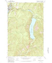
1967 Map of Metaline Falls
USGS Topo · Published 1984About this map
Metaline Falls sits along the Pend Oreille River during the late 1960s, serving as a focal point for industry and infrastructure in northern Pend Oreille County. The town is marked by its industrial character, including a powerplant, gaging stations, and a tramway connecting to the nearby quarry. To the north, the Grandview Mine and Grandview Flats indicate the area's mining history, while the Pend Oreille Village and a local trailer park show the residential footprint of the era.
Find a feature on this map
45 named features on this map. Tap any name to fly to it.
Don’t see what you’re looking for? This feature index may not catch every label — zoom into the map to look around manually.
Map Details
Editions of this 1967 Metaline Falls Map
3 editions found
Other maps of this area

1934 · Metaline
USGS Topo · 1:125,000

1942 · Metaline
USGS Topo · 1:125,000

1958 · Sandpoint
USGS Topo · 1:250,000

1963 · Sandpoint
USGS Topo · 1:250,000

1967 · Gypsy Peak
USGS Topo · 1:24,000

1967 · Ione
USGS Topo · 1:24,000

1967 · Scotchman Lake
USGS Topo · 1:24,000

1967 · Boundary Dam
USGS Topo · 1:24,000

1967 · Metaline
USGS Topo · 1:24,000

1967 · Metaline Falls
USGS Topo · 1:24,000