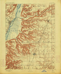
1893 Map of Metamora
USGS Topo · Published 1914About this map
Metamora serves as the focal point of this Central Illinois landscape, which was surveyed just as the regional rail network reached its nineteenth-century maturity. The terrain is defined by the sharp transition from the level prairie uplands of Woodford County to the deeply dissected bluffs overlooking the Illinois River. This dramatic topography, carved by systems like Black Partridge Creek and Crow Creek, dictated the paths of major transportation arteries. Three major lines, including the Chicago Rock Island and Pacific Railroad and the Chicago and Alton Railroad, traverse the sheet, linking river ports like Chillicothe and Rome to inland rail towns such as Cazenovia and Low Point. Small agricultural settlements like Lourds and Germantown appear as tiny clusters within the branching creek valleys, illustrating the early rural settlement patterns of the Illinois River valley before modern road development.
Find a feature on this map
38 named features on this map. Tap any name to fly to it.
Don’t see what you’re looking for? This feature index may not catch every label — zoom into the map to look around manually.
Map Details
Editions of this 1893 Metamora Map
4 editions found
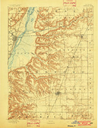
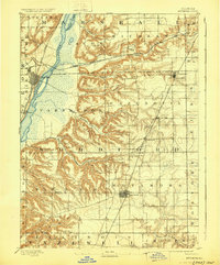
Other maps of this area

1893 · Lacon
USGS Topo · 1:62,500

1893 · Metamora
USGS Topo · 1:62,500

1893 · Dunlap
USGS Topo · 1:62,500

1898 · Dunlap
USGS Topo · 1:62,500

1905 · Peoria
USGS Topo · 1:62,500

1927 · Peoria
USGS Topo · 1:62,500

1927 · Danvers
USGS Topo · 1:62,500

1928 · Mackinaw
USGS Topo · 1:62,500

1930 · Danvers
USGS Topo · 1:62,500

1932 · Mackinaw
USGS Topo · 1:62,500