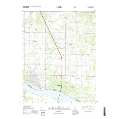
2018 Map of Metropolis
USGS Topo · Published 2018About this map
Metropolis sits prominently along the northern bank of the Ohio River in this 2018 survey, serving as the principal hub of Massac County. The landscape is defined by the convergence of several major tributaries, including Massac Cr, Burnes Cr, and Sevenmile Cr, which flow through a mix of fertile river bottoms and slightly elevated terrain features like Round Knob. To the north, the margins of the Shawnee National Forest indicate the transition into more densely wooded areas.
Find a feature on this map
153 named features on this map. Tap any name to fly to it.
Don’t see what you’re looking for? This feature index may not catch every label — zoom into the map to look around manually.
Map Details
Editions of this 2018 Metropolis Map
This is the sole edition of this map. No revisions or reprints were ever made.
Other maps of this area

1917 · Brownfield
USGS Topo · 1:62,500

1918 · Vienna
USGS Topo · 1:62,500

1919 · Vienna
USGS Topo · 1:62,500

1926 · Paducah
USGS Topo · 1:62,500

1928 · La Center
USGS Topo · 1:62,500

1929 · Paducah
USGS Topo · 1:62,500

1932 · La Center
USGS Topo · 1:62,500

1936 · Paducah
USGS Topo · 1:24,000

1940 · Paducah
USGS Topo · 1:62,500

1942 · Vienna
USGS Topo · 1:62,500