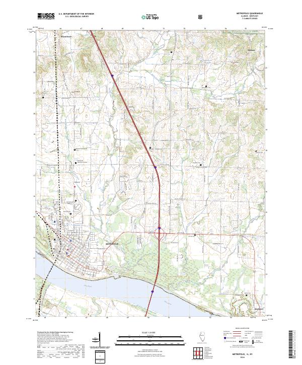
2024 Map of Metropolis
USGS Topo · Published 2024About this map
The Ohio River serves as the southern anchor for this region, defining the state boundary between Illinois and Kentucky. The urban landscape of Metropolis dominates the riverbank, showing a dense grid of streets transitioning into industrial sectors such as Industrial Park Dr. Further east along the water, the smaller settlement of Brookport sits near the border between Massac and McCracken Counties. This area is particularly rich in genealogical data, with numerous burial grounds scattered across the countryside, including Round Springs Cem, Masonic Cem, and the Metropolis Memorial Gardens.
Find a feature on this map
94 named features on this map. Tap any name to fly to it.
Don’t see what you’re looking for? This feature index may not catch every label — zoom into the map to look around manually.
Map Details
Editions of this 2024 Metropolis Map
This is the sole edition of this map. No revisions or reprints were ever made.
Other maps of this area

1917 · Brownfield
USGS Topo · 1:62,500

1918 · Vienna
USGS Topo · 1:62,500

1919 · Vienna
USGS Topo · 1:62,500

1926 · Paducah
USGS Topo · 1:62,500

1928 · La Center
USGS Topo · 1:62,500

1929 · Paducah
USGS Topo · 1:62,500

1932 · La Center
USGS Topo · 1:62,500

1936 · Paducah
USGS Topo · 1:24,000

1940 · Paducah
USGS Topo · 1:62,500

1942 · Vienna
USGS Topo · 1:62,500