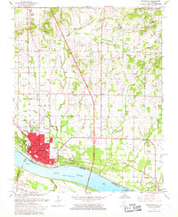
1967 Map of Metropolis
USGS Topo · Published 1968About this map
Fort Massac State Park anchors the Illinois shoreline of the Ohio River in this detailed 1960s study of the riverfront. The city of Metropolis appears at a peak of mid-century development, showing the dense grid of the urban core alongside essential civic institutions like Massac Hospital and the Courthouse. The landscape is defined by the convergence of the Illinois Central Railroad and the Chicago Burlington and Quincy Railroad, which supported the region’s transit and river-based commerce.
Find a feature on this map
48 named features on this map. Tap any name to fly to it.
Don’t see what you’re looking for? This feature index may not catch every label — zoom into the map to look around manually.
Map Details
Editions of this 1967 Metropolis Map
This is the sole edition of this map. No revisions or reprints were ever made.
Other maps of this area

1917 · Brownfield
USGS Topo · 1:62,500

1918 · Vienna
USGS Topo · 1:62,500

1919 · Vienna
USGS Topo · 1:62,500

1926 · Paducah
USGS Topo · 1:62,500

1928 · La Center
USGS Topo · 1:62,500

1929 · Paducah
USGS Topo · 1:62,500

1932 · La Center
USGS Topo · 1:62,500

1936 · Paducah
USGS Topo · 1:24,000

1940 · Paducah
USGS Topo · 1:62,500

1942 · Vienna
USGS Topo · 1:62,500