1890 Map of Mexico
USGS Topo · Published 1906About this map
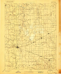
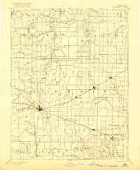
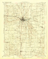
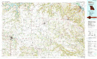
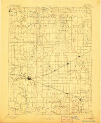
Mexico serves as a central hub for the radiating rail lines of the Chicago and Alton Railroad and the Wabash Railroad during this late nineteenth-century period. The landscape is defined by the dendritic drainage patterns of the Middle Fork of Salt River and the South Fork Salt River, where numerous named branches like Pigeon Roost Creek and Beaver Dam Creek carve through the agricultural townships. This reconnaissance survey captures the specific locations of rural post offices and small settlements such as Santa Fe, Florida, and Shamrock P.O., which were vital community anchors before the consolidation of rural delivery. The map illustrates a transitional economy where established river-oriented towns like Paris coexist with newer rail-dependent villages like Benton City and Laddonia, offering a clear view of the inland Missouri frontier's development into an organized network of townships and transit corridors.
Find a feature on this map
74 named features on this map. Tap any name to fly to it.
Don’t see what you’re looking for? This feature index may not catch every label — zoom into the map to look around manually.
Map Details
Editions of this 1890 Mexico Map
5 editions found