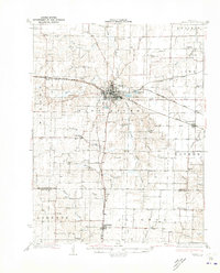
1932 Map of Mexico
USGS Topo · Published 1932About this map
Mexico serves as the focal point of this Central Missouri landscape, situated where the South Fork Salt River meets a dense network of major railroads. The town's significance as a regional hub is evident through the convergence of the Chicago and Alton RR, the Wabash RR, and the Chicago Burlington and Quincy RR. Beyond the urban center, the map reveals a rural society structured around one-room schoolhouses and small country churches. Local landmarks such as the Mo Military Academy and the County Farm provide a look into the institutional history of Audrain County during the early 1930s.
Find a feature on this map
69 named features on this map. Tap any name to fly to it.
Don’t see what you’re looking for? This feature index may not catch every label — zoom into the map to look around manually.
Map Details
Editions of this 1932 Mexico Map
3 editions found
Other maps of this area

1886 · Jefferson City
USGS Topo · 1:125,000

1890 · Mexico
USGS Topo · 1:125,000

1890 · Moberly
USGS Topo · 1:125,000

1890 · Fulton
USGS Topo · 1:125,000

1894 · Jefferson City
USGS Topo · 1:125,000

1928 · Fulton
USGS Topo · 1:62,500

1931 · Fulton
USGS Topo · 1:62,500

1932 · Mexico
USGS Topo · 1:62,500

1940 · Montgomery City
USGS Topo · 1:62,500

1942 · Montgomery City
USGS Topo · 1:62,500