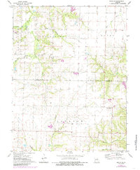
1972 Map of Mexico SE
USGS Topo · Published 1985About this map
The boundary between Audrain Co and Callaway Co runs across this agricultural landscape, where the headwaters of several major regional river systems emerge. The northern portion is defined by the Salt River and its South Fork, while the southeastern corner introduces the drainage of the Loutre River and Bachelor Creek. This map captures a rural Missouri interior dominated by family-named landmarks and scattered community centers. Significant genealogical data is preserved through the location of the New Hope Ch and its adjacent Union Cem, alongside other burial grounds like Lockridge Cem and Unity Cem. In the northeastern quadrant, a local industrial footprint is evident at the Claypits, suggesting the importance of local geological resources during this era of rural development.
Find a feature on this map
24 named features on this map. Tap any name to fly to it.
Don’t see what you’re looking for? This feature index may not catch every label — zoom into the map to look around manually.
Map Details
Editions of this 1972 Mexico SE Map
2 editions found
Other maps of this area

1890 · Mexico
USGS Topo · 1:125,000

1890 · Fulton
USGS Topo · 1:125,000

1928 · Fulton
USGS Topo · 1:62,500

1931 · Fulton
USGS Topo · 1:62,500

1932 · Mexico
USGS Topo · 1:62,500

1940 · Montgomery City
USGS Topo · 1:62,500

1942 · Montgomery City
USGS Topo · 1:62,500

1942 · Wellsville
USGS Topo · 1:62,500

1948 · Quincy
USGS Topo · 1:250,000

1949 · Saint Louis
USGS Topo · 1:250,000