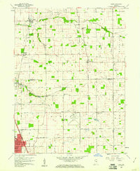
1959 Map of Miami
USGS Topo · Published 1978About this map
Deer Creek and its tributaries carve a winding path across the agricultural landscape of Miami and Howard Counties in the late 1950s. The northern edge of Kokomo begins its northward expansion, anchored by the Kokomo Municipal Airport and the residential blocks around Bon Air Park. Rural life remains centered on historic crossroads like Wawpecong and Bennetts Switch, where the New York Chicago and St Louis RR and Pennsylvania RR lines intersect the grid of county roads.
Find a feature on this map
52 named features on this map. Tap any name to fly to it.
Don’t see what you’re looking for? This feature index may not catch every label — zoom into the map to look around manually.
Map Details
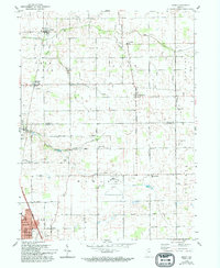
Editions of this 1959 Miami Map
3 editions found
Other maps of this area

1951 · Onward
USGS Topo · 1:24,000

1951 · Bunker Hill
USGS Topo · 1:24,000

1953 · Peoria
USGS Topo · 1:24,000

1953 · Danville
USGS Topo · 1:250,000

1953 · Muncie
USGS Topo · 1:250,000

1955 · Danville
USGS Topo · 1:250,000

1956 · Muncie
USGS Topo · 1:250,000

1956 · Danville
USGS Topo · 1:250,000

1959 · Galveston
USGS Topo · 1:24,000

1959 · Miami
USGS Topo · 1:24,000