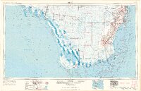
1956 Map of Miami
USGS Topo · Published 1969About this map
The Everglades dominate this mid-century landscape, illustrating the contrast between the expanding urban corridors of Dade County and the sprawling protected wilderness of Everglades National Park. To the east, the metropolitan sprawl from Hialeah and Coral Gables down to Homestead is clearly defined, showing the residential and commercial density supported by the Florida East Coast railway and the Tamiami Trail. Outside the coastal ridge, the map reveals a remote network of ranger stations, such as the Royal Palm Ranger Station and Cape Sable Ranger Station, alongside small outposts like Everglades City and Chokoloskee. The map documents the intricate canal systems like the Tamiami Canal and Miami Canal, which were essential for managing water across the limestone wetlands, while the coastline is marked by historic maritime markers including Fowey Rocks Lighthouse and the scattered keys of the Ten Thousand Islands.
Find a feature on this map
209 named features on this map. Tap any name to fly to it.
Don’t see what you’re looking for? This feature index may not catch every label — zoom into the map to look around manually.
Map Details
Editions of this 1956 Miami Map
5 editions found

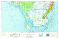

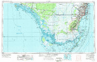
Other maps of this area

1947 · North Miami
USGS Topo · 1:24,000

1947 · Key Biscayne
USGS Topo · 1:24,000

1947 · Garden Cove
USGS Topo · 1:24,000

1947 · Rock Harbor
USGS Topo · 1:24,000

1947 · Blackwater Sound
USGS Topo · 1:24,000

1948 · Soldier Key
USGS Topo · 1:24,000

1949 · Blackwater Sound
USGS Topo · 1:24,000

1949 · Rock Harbor
USGS Topo · 1:24,000

1949 · Opalocka
USGS Topo · 1:24,000

1949 · Garden Cove
USGS Topo · 1:24,000