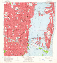
1962 Map of Miami
USGS Topo · Published 1964About this map
Miami and Miami Beach appear here in a period of intense coastal development and urban expansion. The mid-century city is defined by its complex waterway network, featuring the dredging and filling of the Venetian Islands and Normandy Isle within Biscayne Bay. Long-standing neighborhoods such as Lemon City, Allapattah, and Buena Vista are shown in detail, alongside the industrial and transit corridors of the Florida East Coast and Seaboard railroads. Significant cultural landmarks are prominent, including the Orange Bowl, Miami Stadium, and the historic City Cemetery. The map captures the infrastructure connecting the mainland to the beach, such as the Julia Tuttle Causeway and Mac Arthur Causeway, highlighting the era's reliance on these vital arterial links to support the growing tourist and residential populations.
Find a feature on this map
153 named features on this map. Tap any name to fly to it.
Don’t see what you’re looking for? This feature index may not catch every label — zoom into the map to look around manually.
Map Details
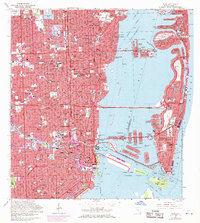
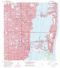
Editions of this 1962 Miami Map
3 editions found
Other maps of this area

1947 · North Miami
USGS Topo · 1:24,000

1947 · Key Biscayne
USGS Topo · 1:24,000

1949 · Opalocka
USGS Topo · 1:24,000

1949 · Key Biscayne
USGS Topo · 1:24,000

1950 · Hialeah
USGS Topo · 1:24,000

1950 · Miami
USGS Topo · 1:24,000

1950 · North Miami
USGS Topo · 1:24,000

1950 · South Miami
USGS Topo · 1:24,000

1956 · South Miami
USGS Topo · 1:24,000

1956 · Miami
USGS Topo · 1:250,000