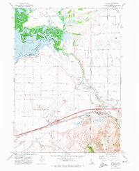
1971 Map of Michaud
USGS Topo · Published 1974About this map
The Fort Hall Bottoms and Michaud Flats define this 1970s landscape where the Portneuf River meets the American Falls Reservoir. This era shows a complex water management and industrial footprint, characterized by an extensive network of irrigation canals including the Union Canal and numerous numbered laterals like Lateral 17 and Lateral 5. The industrial and infrastructure development of the period is evident in the Pocatello Municipal Airport, the Industrial Waste Ponds south of Chubbuck, and the Union Pacific rail lines. Local history is anchored by the Reider Cemetery and an Indian Cem within the Fort Hall Indian Reservation, alongside established agricultural markers like the Storage Bins and a Fish Hatchery near Baptiste Springs Pumping Sta.
Find a feature on this map
67 named features on this map. Tap any name to fly to it.
Don’t see what you’re looking for? This feature index may not catch every label — zoom into the map to look around manually.
Map Details
Editions of this 1971 Michaud Map
4 editions found
Other maps of this area

1934 · Michaud
USGS Topo · 1:62,500

1937 · Pocatello
USGS Topo · 1:48,000

1937 · Michaud
USGS Topo · 1:62,500

1940 · Blackfoot
USGS Topo · 1:62,500

1943 · Blackfoot
USGS Topo · 1:62,500

1944 · Pocatello
USGS Topo · 1:62,500

1954 · Pocatello
USGS Topo · 1:250,000

1955 · Pingree
USGS Topo · 1:24,000

1955 · Springfield
USGS Topo · 1:24,000

1955 · Idaho Falls
USGS Topo · 1:250,000