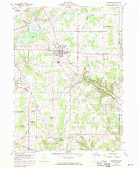
1959 Map of Middlefield
USGS Topo · Published 1971About this map
Middlefield stands as the central hub of this Geauga County landscape, where the local economy and settlement patterns are closely tied to the diverse waterways and rail corridors of northeast Ohio. The town’s relationship with the land is visible in the network of roads and rail lines that converge near its center, supporting a mix of agricultural and industrial activity. To the west, Burton Station marks a significant waypoint along the rail line, while the terrain is shaped by the headwaters and branches of several prominent regional rivers.
Find a feature on this map
9 named features on this map. Tap any name to fly to it.
Don’t see what you’re looking for? This feature index may not catch every label — zoom into the map to look around manually.
Map Details
Editions of this 1959 Middlefield Map
Other maps of this area

1904 · Chardon
USGS Topo · 1:62,500

1905 · Bristolville
USGS Topo · 1:62,500

1905 · Garrettsville
USGS Topo · 1:62,500

1905 · Jefferson
USGS Topo · 1:62,500

1906 · Chardon
USGS Topo · 1:62,500

1907 · Bristolville
USGS Topo · 1:62,500

1907 · Jefferson
USGS Topo · 1:62,500

1907 · Garrettsville
USGS Topo · 1:62,500

1950 · Cleveland
USGS Topo · 1:250,000

1952 · West Farmington
USGS Topo · 1:24,000
Featured Places
- Mesopotamia Township, OH
- Farmington Township, OH
- Burton Township, OH
- Maple Grove, Troy Township
- Parkman Township, OH