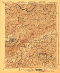
1930 Map of Middlesboro
USGS Topo · Published 1941About this map
Middlesboro anchors this tri-state region where Kentucky, Tennessee, and Virginia converge at the famed Cumberland Gap. The landscape is dominated by the massive ridges of Pine Mountain and Brush Mountain, with the Cumberland River and Powell River carving complex drainage patterns through the valleys. The map documents a dense network of mountain communities and educational landmarks, most notably the campus of Lincoln Memorial University near Harrogate. The industrial and social fabric of the 1920s is evident in the numerous mountain schools like Happy Valley Sch and Faydale Sch, alongside the operations of the Louisville and Nashville and Southern Railway. From the heights of The Pinnacle to the agricultural crossroads at Patterson Crossroads, the map preserves the precise location of family-named landmarks and rural institutions during a period of significant regional growth.
Find a feature on this map
117 named features on this map. Tap any name to fly to it.
Don’t see what you’re looking for? This feature index may not catch every label — zoom into the map to look around manually.
Map Details
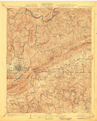
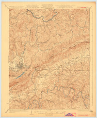
Editions of this 1930 Middlesboro Map
4 editions found

Other maps of this area

1883 · Morristown
USGS Topo · 1:125,000

1886 · Cumberland Gap
USGS Topo · 1:125,000

1887 · Jonesville
USGS Topo · 1:125,000

1888 · Cumberland Gap
USGS Topo · 1:125,000

1891 · Cumberland Gap
USGS Topo · 1:125,000

1891 · Jonesville
USGS Topo · 1:125,000

1893 · Morristown
USGS Topo · 1:125,000

1895 · Morristown
USGS Topo · 1:125,000

1897 · Maynardville
USGS Topo · 1:125,000

1900 · Maynardville
USGS Topo · 1:125,000