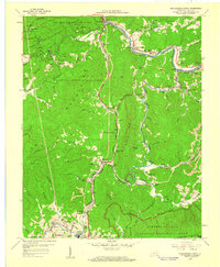
1959 Map of Middlesboro North
USGS Topo · Published 1960About this map
The industrial and cultural landscape of the Cumberland Mountains is prominently displayed in this late-1950s survey of Bell County. Middlesboro anchors the southern valley, showing a dense grid of streets and rail infrastructure that transitions into the community of Binghamtown. To the north, the Cumberland River carves a winding path through the ridges, passing the small settlements of Wasioto and Harbell. The regional economy is evident through the widespread Strip Mines and the prominent Louisville and Nashville Railroad line that follows the river's course.
Find a feature on this map
84 named features on this map. Tap any name to fly to it.
Don’t see what you’re looking for? This feature index may not catch every label — zoom into the map to look around manually.
Map Details
Editions of this 1959 Middlesboro North Map
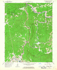
2 editions found
Other maps of this area

1886 · Cumberland Gap
USGS Topo · 1:125,000

1888 · Cumberland Gap
USGS Topo · 1:125,000

1891 · Cumberland Gap
USGS Topo · 1:125,000

1903 · Pineville
USGS Topo · 1:48,000

1903 · Middlesboro
USGS Topo · 1:48,000

1927 · Middlesboro
USGS Topo · 1:62,500

1930 · Middlesboro
USGS Topo · 1:62,500

1935 · Varilla
USGS Topo · 1:24,000

1935 · Mingo Mountains
USGS Topo · 1:24,000

1935 · Cumberland Gap
USGS Topo · 1:24,000