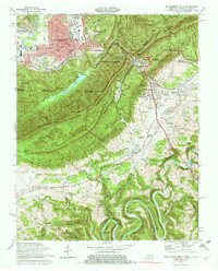
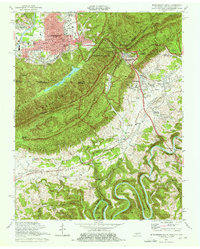
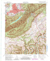
1974 Map of Middlesboro South
USGS Topo · Published 1976About this map
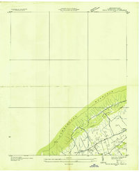
Cumberland Gap National Historical Park anchors this mid-1970s survey, highlighting the convergence of Kentucky, Tennessee, and Virginia at Tri State Peak. The landscape is dominated by the steep ridge of Cumberland Mountain, which separates the urban expansion of Middlesboro in the north from the educational hub of Lincoln Memorial University and Harrogate in the south. The mapping of the Wilderness Road and the L & N RR through the gap underscores the area's role as a vital passage through the Appalachians.
Find a feature on this map
93 named features on this map. Tap any name to fly to it.
Don’t see what you’re looking for? This feature index may not catch every label — zoom into the map to look around manually.
Map Details
Editions of this 1974 Middlesboro South Map
3 editions found
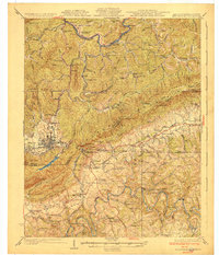
Other maps of this area

1886 · Cumberland Gap
USGS Topo · 1:125,000

1888 · Cumberland Gap
USGS Topo · 1:125,000

1891 · Cumberland Gap
USGS Topo · 1:125,000

1897 · Maynardville
USGS Topo · 1:125,000

1900 · Maynardville
USGS Topo · 1:125,000

1903 · Middlesboro
USGS Topo · 1:48,000

1927 · Middlesboro
USGS Topo · 1:62,500
1930 · Middlesboro
USGS Topo · 1:62,500

1935 · Varilla
USGS Topo · 1:24,000
1935 · Mingo Mountains
USGS Topo · 1:24,000