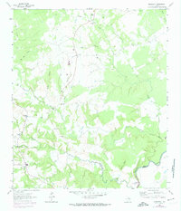
1964 Map of Middleton
USGS Topo · Published 1974About this map
The Middleton landscape in the mid-1960s was defined by scattered rural outposts and the winding path of Lower Keechi Creek. Small community hubs like Guys Store and Spillers Store served the local farming and ranching population, connected by a network of light-duty roads and fence lines. The presence of several family and community burial grounds, such as Thomason Cem and Spillerville Cem, along with Mount Airy Ch, highlights a deeply rooted social structure.
Find a feature on this map
38 named features on this map. Tap any name to fly to it.
Don’t see what you’re looking for? This feature index may not catch every label — zoom into the map to look around manually.
Map Details
Editions of this 1964 Middleton Map
3 editions found
Other maps of this area

1953 · Palestine
USGS Topo · 1:250,000

1957 · Palestine
USGS Topo · 1:250,000

1964 · Sand Ridge
USGS Topo · 1:24,000

1964 · Austonio
USGS Topo · 1:24,000

1964 · Centerville
USGS Topo · 1:24,000

1964 · Eunice
USGS Topo · 1:24,000

1964 · Middleton
USGS Topo · 1:24,000

1964 · Halls Bluff
USGS Topo · 1:24,000

1964 · Leona
USGS Topo · 1:24,000
1964 · Elwood
USGS Topo · 1:24,000