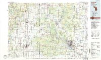
1984 Map of Midland
USGS Topo · Published 1989About this map
The Tittabawassee River and its major tributaries, including the Tobacco River and Chippewa River, anchor this 1980s landscape at the confluence of agricultural and forested lands. The urban centers of Midland and Mount Pleasant show significant development, while the northern reaches transition into the sprawling Au Sable State Forest. Water management is a defining characteristic of the region, evidenced by the large reservoirs of Wixom Lake and Sanford Lake that regulate the river system.
Find a feature on this map
75 named features on this map. Tap any name to fly to it.
Don’t see what you’re looking for? This feature index may not catch every label — zoom into the map to look around manually.
Map Details
Editions of this 1984 Midland Map
2 editions found
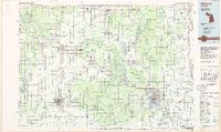
Other maps of this area

1916 · Bay City
USGS Topo · 1:62,500

1916 · Mount Pleasant
USGS Topo · 1:62,500

1917 · St. Charles
USGS Topo · 1:62,500

1919 · Mount Pleasant
USGS Topo · 1:62,500

1919 · Bay City
USGS Topo · 1:62,500

1919 · Saginaw
USGS Topo · 1:62,500

1930 · Shepherd
USGS Topo · 1:48,000

1934 · Sanford
USGS Topo · 1:62,500

1934 · Merrill
USGS Topo · 1:62,500

1935 · Alma
USGS Topo · 1:62,500