
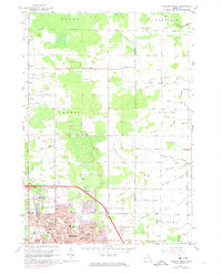
1962 Map of Midland North
USGS Topo · Published 1964About this map
The industrial and suburban expansion of Midland is documented here during the early 1960s, showing the northward growth of the city toward the townships of Larkin and Beaver. The landscape is a distinct mix of residential development and industrial utility, characterized by an extensive network of Brine Wells and drainage infrastructure like the Miller Drain and Pashak Drain. Education is a central theme in the rural outskirts, with numerous country schoolhouses such as Hubbard Sch, Duel Sch, and Gray Sch still serving their respective districts.
Find a feature on this map
88 named features on this map. Tap any name to fly to it.
Don’t see what you’re looking for? This feature index may not catch every label — zoom into the map to look around manually.
Map Details
Editions of this 1962 Midland North Map
2 editions found
Other maps of this area

1934 · Sanford
USGS Topo · 1:62,500

1936 · Sanford
USGS Topo · 1:62,500

1954 · Midland
USGS Topo · 1:250,000

1958 · Midland
USGS Topo · 1:250,000

1959 · Midland
USGS Topo · 1:250,000

1962 · Willard
USGS Topo · 1:24,000

1962 · Midland South
USGS Topo · 1:24,000
1962 · Auburn
USGS Topo · 1:24,000

1966 · Midland
USGS Topo · 1:250,000
1967 · Crump
USGS Topo · 1:24,000