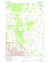
1962 Map of Midland North
USGS Topo · Published 1974About this map
Subsurface brine extraction defines the landscape of Larkin and the surrounding townships in the early 1960s, evidenced by numerous Brine Wells dotting the township lines. The northern expansion of Midland is documented in detail, showing a planned network of parks and schools such as Chestnut Hill Sch and Greenfield Park pushing into formerly rural territory. Rural life remains centered on local institutions like the Larkin Ch and a series of district schoolhouses including Gray Sch and Leiphart Sch. The drainage system is heavily engineered, with named features like Wenglikowski Drain and Sequin Drain channeling water through the agricultural lands of Beaver and Williams. This survey also identifies several residential hubs and small clusters like Hubbard Circle and Bleshenski, alongside the industrial presence of a Radio Tower and Substation near the emerging urban fringe.
Find a feature on this map
84 named features on this map. Tap any name to fly to it.
Don’t see what you’re looking for? This feature index may not catch every label — zoom into the map to look around manually.
Map Details
Editions of this 1962 Midland North Map
2 editions found
Other maps of this area

1934 · Sanford
USGS Topo · 1:62,500

1936 · Sanford
USGS Topo · 1:62,500

1954 · Midland
USGS Topo · 1:250,000

1958 · Midland
USGS Topo · 1:250,000

1959 · Midland
USGS Topo · 1:250,000

1962 · Willard
USGS Topo · 1:24,000

1962 · Midland South
USGS Topo · 1:24,000

1962 · Midland North
USGS Topo · 1:24,000
1962 · Auburn
USGS Topo · 1:24,000

1966 · Midland
USGS Topo · 1:250,000